the 2005 8th Annual RMM Rendevous, June 24th - 26th, 2005, day 1
Greetings all,
Well, I'm sorry we didn't have a better turnout for this year's Rocky Mountain Moggers outing.
I have to admit it wasn't as well organized as I've tried to make them in the past, but circumstances didn't permit.
Regardless, we did set the dates and tried to get advance notice out to as many folks as possible. Some, who had planned to make it had to
cancel at the last minute for reasons beyond their control, and that's understandable. By noon on Friday we had four Unimogs present:
Robert and Charlie Christensen (Cheyenne, WY) in their 416 Doka,
Ron Miller (Ft. Collins, CO) in his very nice 404.1 Hardcab (it's for sale by the way :-) ,
Ron DePugh in his 404.1 VLF,
and me (Kent Drummond) in my 404.1 Hardcab with Swiss bed.
The Christensens and I caravaned down from Cheyenne, and had to take I-70 up to Idaho Springs from Devner because eariler in the week
a rock slide dropped 200 tons of rock onto Highway 6 (Clear Creek Canyon). The canyon is my preferred route out of Denver because the
grade is gradual. I-70 has a couple major hills which are a real grunt for the old 404.
The Christensens and Ron Miller departed around 12:30 to head up in to the high country and set up camp. I had said I'd hang around
the USFS visitor's center from noon til 2:00, in case any showed up late.
Kristopher Dichtl stopped by on his way back from visiting Mario LaRouche in Aspen that day, but he didn't have his mog.
Ron DePugh got a late start out of Denver and arrived about 2:00. Had a nice visit with Kristopher and then Ron and I headed out for a
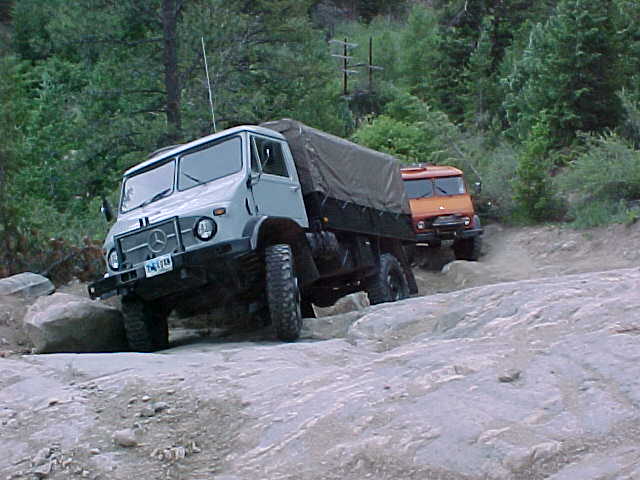
new trail to us called "Silver Creek Trail". This is one Bob Ragain and I had started down from the upper end back in 2001, but we
encountered a bunch of Jeeps before going to far and had to back up. The guys in the Jeeps informed us it was pretty much a one way trail
(up), so we noted it as a trail to try at a future time. The Jeep guys were impressed by the mogs and commented they'd like to see how
the mogs would do in the "boulder field".
To get to the start of the Silver Creek Trail, we had to continue west from Idaho Springs on I-70 for another five miles.
The trail starts in a little community called Lawson. Not having done this trail before, it took some trial and error poking around to
finally get on the right road. I had waypoints from my TOPO program, but they just served to tell me I was headed in the wrong
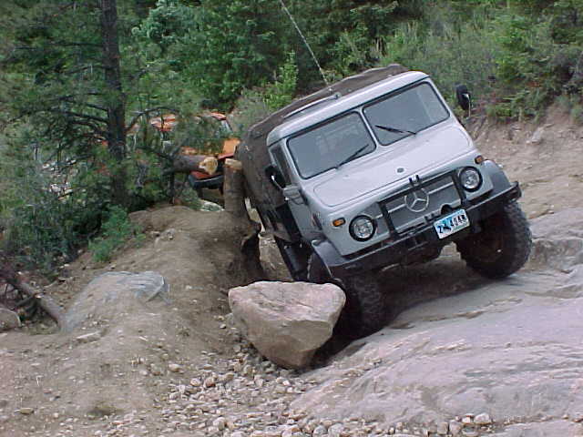
direction, so had to turn around. We got started eventually, but missed one important turn and ended up at an impressive obstacle
right off the bat. It was a steep rock slab which rose about 30 feet. For those of you who are familiar with the rock slab on the way
up to Cleveland Lake above Holy Cross City, CO, this one made the Cleveland Lake obstacle look like a residential driveway. Well, I
figured what the heck, lock the differentials, put it in first gear and up we go. That went well until I lost traction on the loose dirt
covering the rock and started to crab off to the right, ending up with my right front wheel wedged against a boulder and a tree stump
sticking into the canvas on the right rear of the bed.
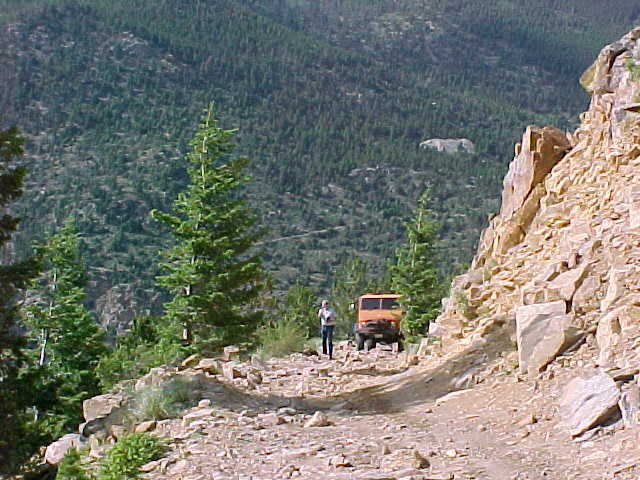
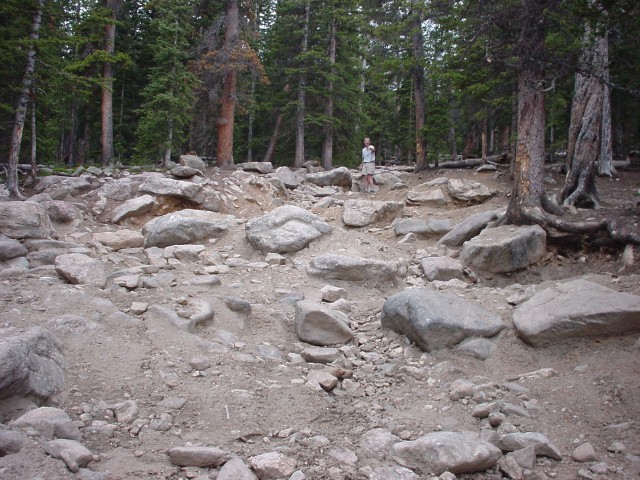
Stuck on a rock..
..and a tree stump.
There was no way I was going to be able to drive out of this fix. My winch is mounted in the rear, so that
was no help, and Ron was behind me. Fortunately, he had his newly installed PTO winch from Scott Ingham at Expedition-Imports (that's a
plug :-) ) and I have a big snatch block, so we ran the winch cable up the hill, anchored the snatch block to a substantial tree, and then
back to my front bumper.
This was the innaugural application of Ron's winch, and I'm pleased to say it worked slick. He pulled me away from that rock with ease,
and as soon as I was free I was able to get traction and advance to a slightly more level spot.
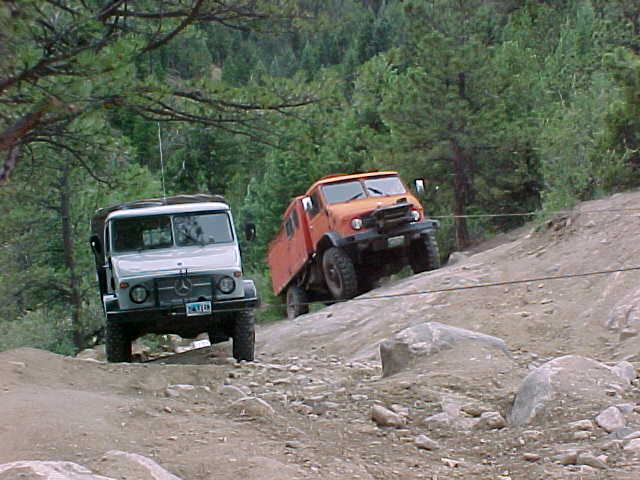
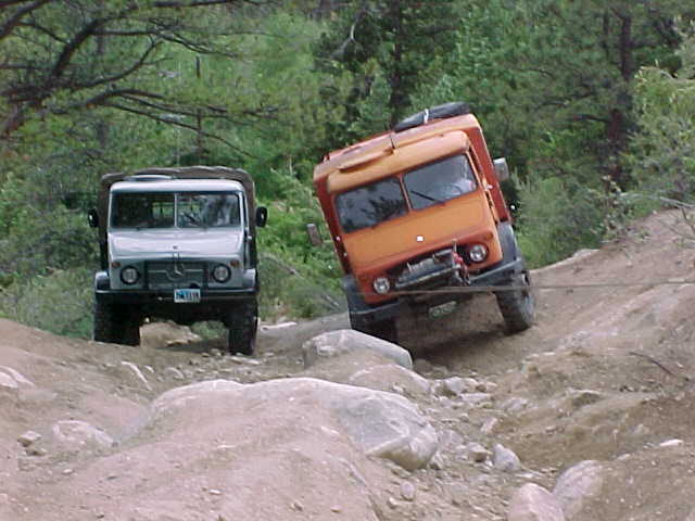
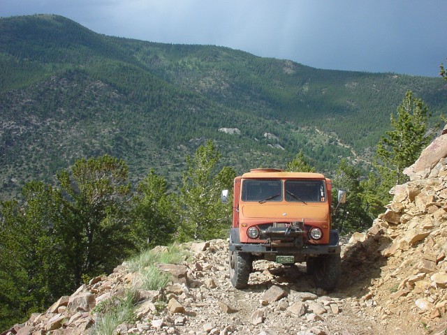
Then, with me serving as the anchor, Ron winched himself up the rock face, stopping beside me.
winching Ron up the rock face.
to a more level place.
Unfortunately, Ron had left the back end of his firebox open before starting up the hill, so the angle of
the slope and gravity emptied the entire back end of his truck. All his gear was piled at the bottom of the hill. Four or five trips each,
with a great deal of huffing and puffing, and we had all his gear lugged up the hill and loaded back in the truck. We were still fairly
low at this point, about 8,500 feet. This little obstacle delayed our trip by about an hour, but we were finally on our way. The road
turned out to be in pretty good shape up to the point where the more difficult part starts at about 8,970 feet.
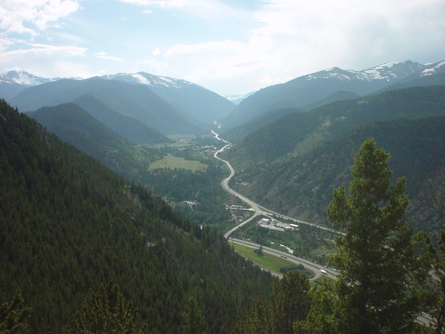
From there, the road follows the contour of the mountain around to the west and then starts to climb. From a clear spot on the road
(9,300') we had a nice view down onto the fork of I-70 and US-40, about 1,100 feet below us.
The view of I-70.
Ron stopped at the view point to take a picture also.
The road looks fairly rough here.. Not!
Kent at the view point.
The road continued to climb steeply up the mountain, but didn't present any real diffuculties. At one point,
we passed what appeared to be a short cut, but elected to follow what showed on the map as the main road. Unfortunately, it became a dead
end at an old mine after about 1000', so we had to get ourselves turned around and backtrack to the "shortcut". There was a bit of an
awkward climb at the beginning of the shortcut, but difflocks handled it nicely.
At 10,500', we crossed into the Arapahoe National Forest and were at a point on the trail known as the boulder field. I had expected to
find an exposed area, like a rock slide, but instead it is just a long, steep segment of road where the loose dirt has pretty much eroded
away and large, exposed boulders comprise the track. Just as we were starting through this stretch, it started to rain. I made it through
a narrow spot between two big trees and kept going, because I was afraid if I was to stop the rocks would be so slick that it would be
impossible to get going again. I didn't see Ron coming behind me, and a check on the CB confirmed that he had gotten stuck trying to get
through the same narrow spot. I told him I'd hike back down as soon as I could get to a spot where I could safely get restarted, but
nothing presented itself and it began to rain harder and harder. Ron finally called me on the CB, saying that he'd made it through and
was on his way up. I stopped at the first opportunity, and waited until he caught up. By that time, the rain was coming down so hard that
the road had turned into a roaring stream, with lightning and thunder occuring almost simultaneously.
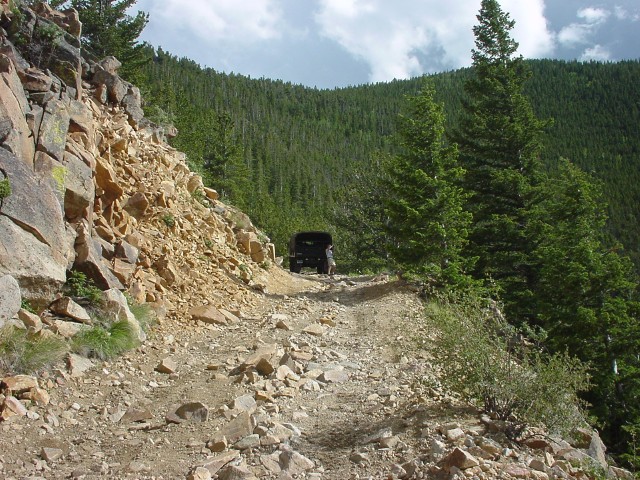
Kent in the Boulder field before the rain started.
We finally rolled into the rendevous campsite at 7:00 p.m. The Christensens and Ron Miller had been there
for some time, having come up a different route, and the Christensen's big tent was a welcome haven out of the pouring rain. The rain
finally let up so Ron and I were able to start setting up our own trucks for the night. Ron discovered that he had suffered some damage
on the trail, with one side door being jarred out of place, and a crunch in the upper rear corner of the fire box from wriggling through
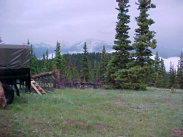
the narrow trees. From our camp at 11,133' we could see that the valley below was filled with cloud.
The clouds in the valley below.
Trip Report by Kent Drummond photos by Kent Drummond and Ron DePugh