the 2005 8th Annual RMM Rendevous, June 24th - 26th, 2005, day 2
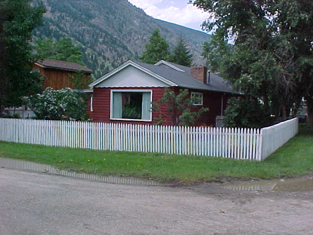
We had rain, lightning and thunder most of the night, but the morning arrived with sunshine. After a filling breakfast of eggs, bacon, and hash browns
at Chez Christensen, we broke camp and were on the trail by 9:30 a.m.
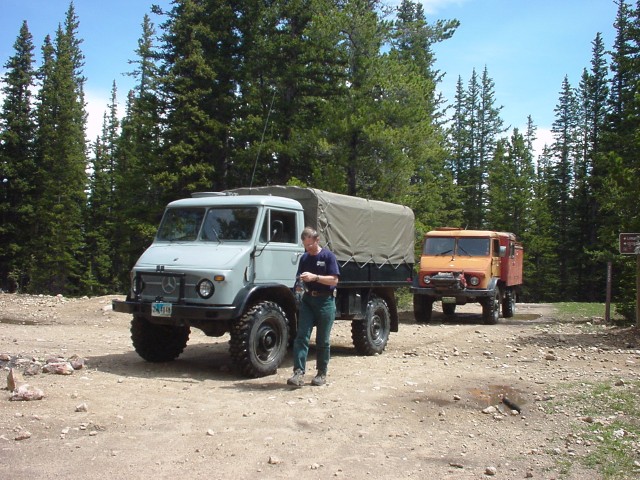
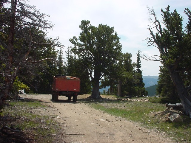
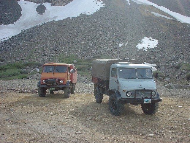
Robert and Charlie's 416 Doka.
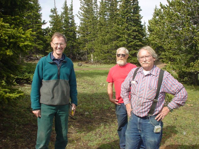
Kent and the Christensen brothers.
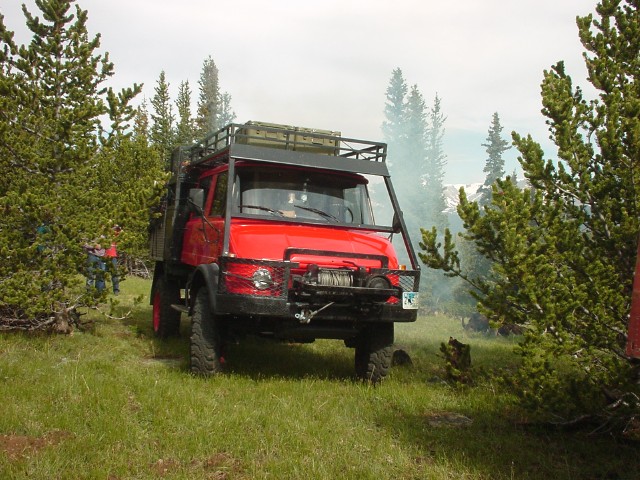
Ron Miller and his 404.1.
My first objective was the top of Saxon Mountain, but I wanted to go by a round about trail that I hadn't explored previously. The trail started out
okay, but eventually became quite narrow with low overhead branches. The Christensens and Ron Miller elected not to go any further and made the decision to head back down out of
the mountains. Ron DePugh and I persevered, but it was costly. I got my passenger side mirror ripped off, which fell under the rear wheel
and was crunched. Ron took a major hit to the top of his VLF fire box. None of this would have been so bad had the road not been a dead end. We were within 1,600' of where I was
hoping to rejoin the Saxon Mt. road and had to turn around and backtrack through all that brutal trail. Shortly before we rejoined the better road, we had brief radio contact with
Ron Miller, but they were too far along in their descent to Idaho Springs to turn around and rejoin us.
Ron and I continued along the better road, turning at a major intersection to head up to the summit of Saxon Mountain.
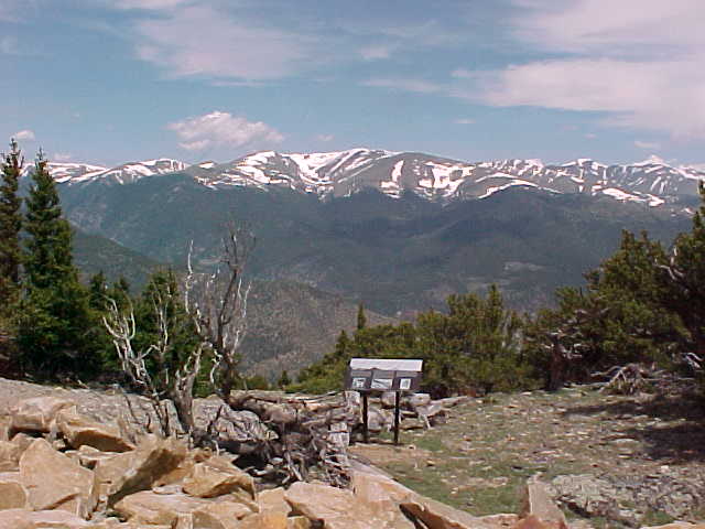
At the summit, there were several information signs describing the names of distant peaks,
and giving a history of the discovery of silver on Saxon Mountain.
There was also an array of cellular antennas, as the summit has a commanding view over much of the I-70 corridor through the mountains.
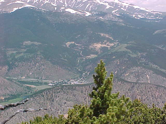
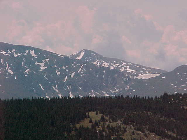
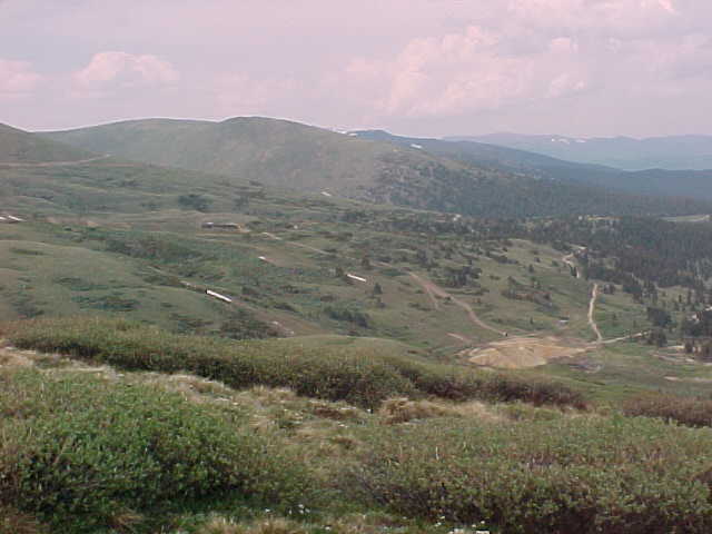
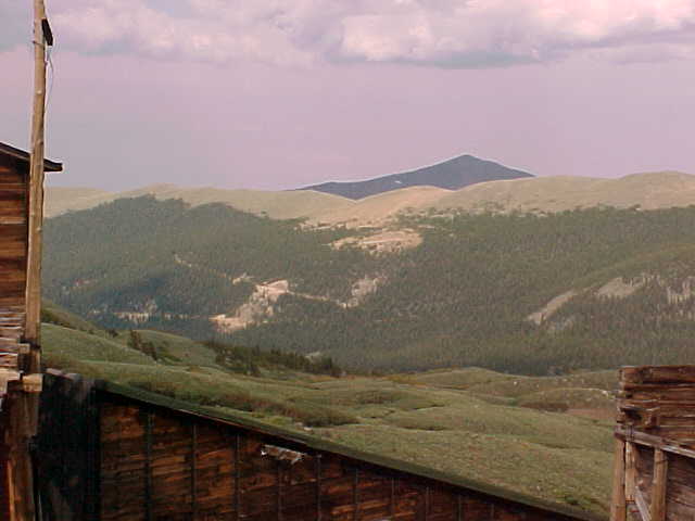
From our vantage point on the summit we could look down on the town of Empire to the north, 2,900' below. You can see the mountain side covered with mine dumps above Empire from the gold and silver mining days.
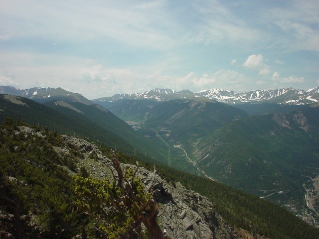
Moving around to the west side of the summit we could look down on Georgetown, 3,000' below. Our destination camp for this night was at the base of the mountains off in the distance.
Georgetown and the road to Guanella Pass.
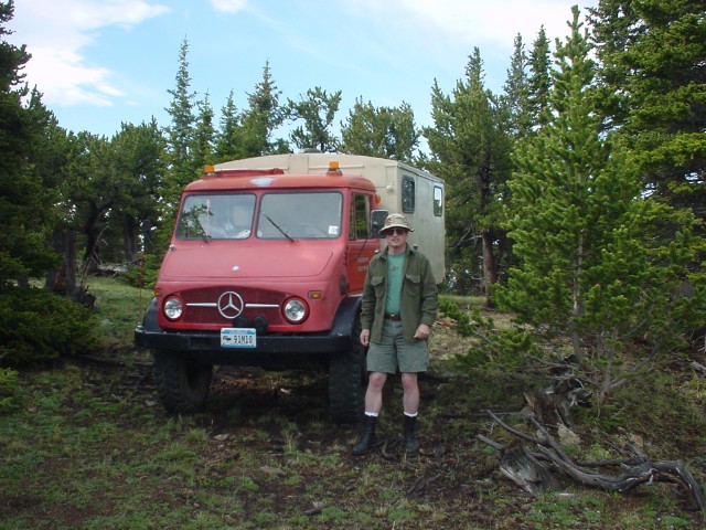
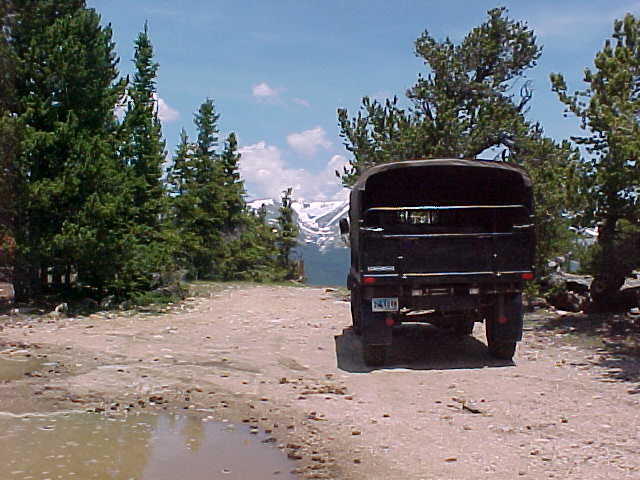
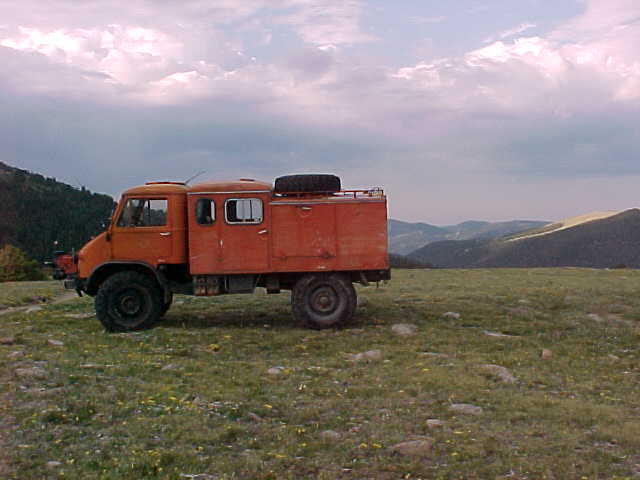
Ron's Mog at the summit of Saxon Mt.
Looking off to the north again, we could see James Peak in the distance, which was the area where we conducted RMM 2001..
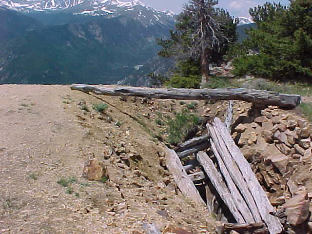
This mine shaft was one of many on the very summit of Saxon Mountain. The miners just picked a spot and started swinging their picks, in hopes of finding a vein of silver.
After reading all the informational signs we headed down toward Georgetown. In the distance you can see the summit of Mt. Evans, the subject of my MogEvans trip reports.
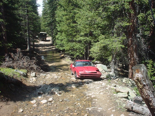
Along the trail we came upon a recently abandoned Subaru sports car that some idiot had tried to drive up the mountain. It was pretty beat up and I'm surprised it had made it as far as it did.
There was also an array of cellular antennas, as the summit has a commanding view over much of the I-70 corridor through the mountains.
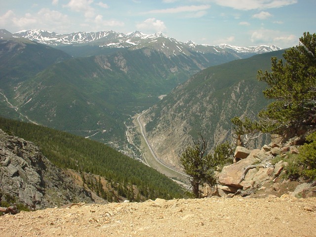
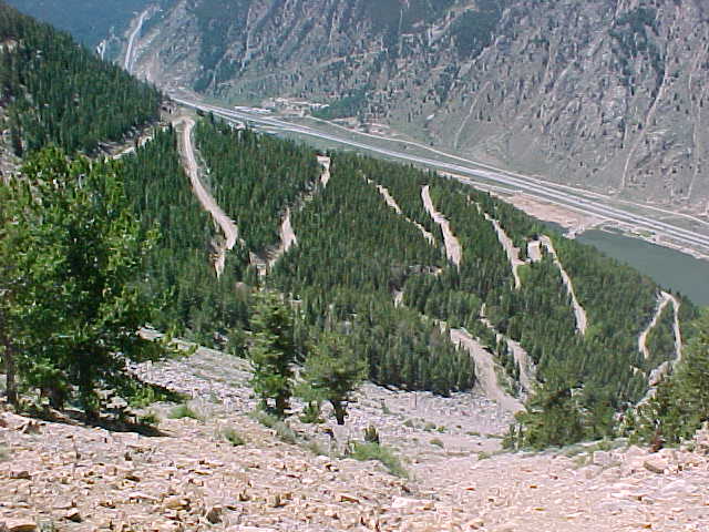
The Saxon Mt. road eventually comes into an area where you have a clear view of I-70 and Georgetown way down below. The switchbacks you see are our ultimate route down the mountain.
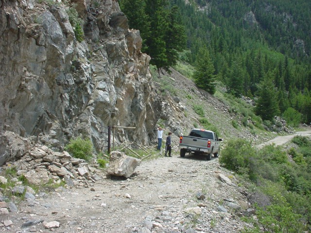
A rock fell onto the niddle of the road, blocking it completely. It took Kent and I, and the guy from this pickup to move the rock to the side of the road, so we could get around it. -Ron D.
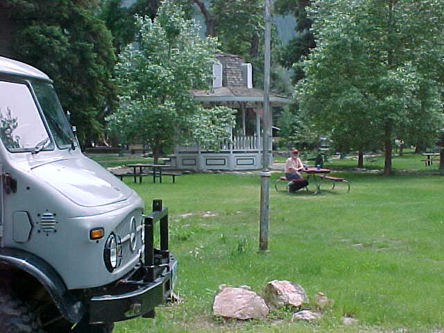
In Georgetown, we stopped at the little town park for lunch.
Across the street from the park is the house that was built by the owner of Arapahoe Basin Ski Area back in the early 1950's. I lived here during my teenage summers when I was working at the ski area, clearing trails and installing lifts.
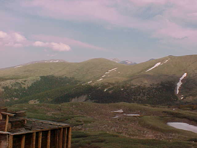
From Georgetown, we headed up the Guanella Pass road for a couple miles and then cut off to the old railroad grade that heads up toward the old mining community of Waldorf (11,600').
From the huge mine dump at Waldorf, we headed up the road toward Argentine Pass, but ran into snow at 12,250' and had to turn back. You can see the mine dump at Waldorf in the
center right of the picture.
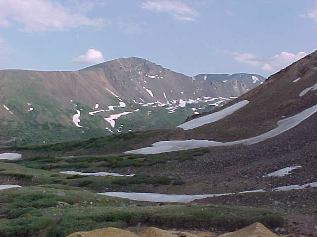
After we got back to Waldorf, we headed up again along the old RR grade. Back in the 1800's a tourist train brought people in open sided cars all the way from Silver Plume to the
top of McClellan Mountain at 12,900' for a specacular view of the Continental Divide. Once again, we were thwarted by snow blocking the road. Unfortunately, the road was too narrow
to turn around, so we had to back up for about 3,000'. Fortunately, the inside curve and high side of the road was on the driver's side, so I didn't have to depend on my missing
passenger mirror. That's probably a good thing, because I never knew how close I might have come to the edge of the narrow road.
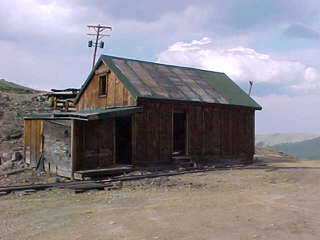
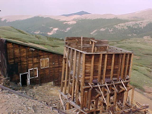
Once we got to an intersection where we could turn around, we followed around to the old Santiago Mine, where most of the buildings are still standing. Beyond this piece of mine
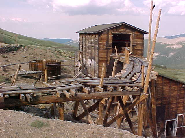
aparatus, you can see the ore car rails leading into the opening of the mine tunnel.
This building was probably an office and living quarters for the operators of the mill.
Ore came out of the mine and traveled across this tressle to his building, where it was dumped down a chute..
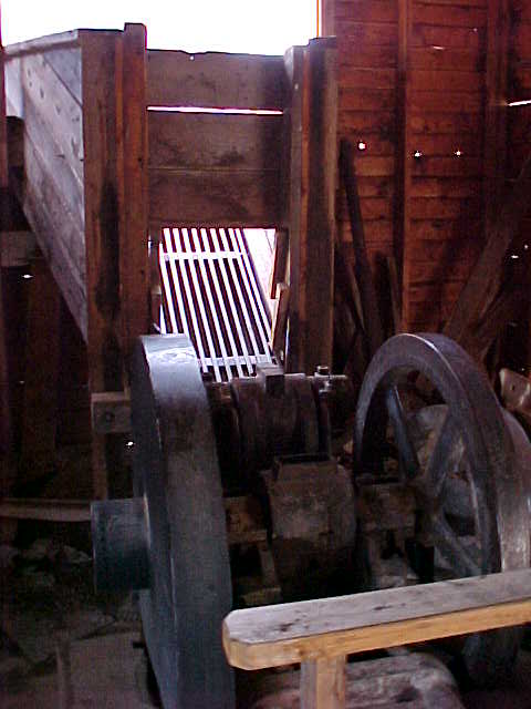
..into a preliminary rock crusher.
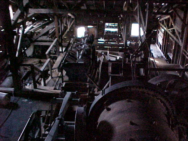
From there the ore dropped into a rotating drum in the lower building...
..where assorted pieces of machinery separated out the precious metals.
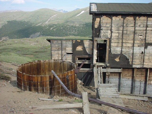
We can only assume that this round tub contained water which was used in the milling process..
If you visualize the following pictures from left to right you can see the mountains lining the southern side of the valley we viewed from the mine..
By this time it was getting late,.
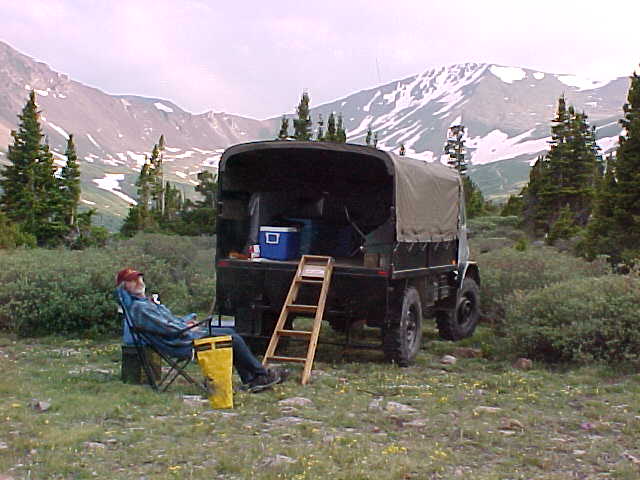
..so we headed to a lower elevation (11,740') to make camp for the night.
Through the gap in the trees, above my truck's right front, you can just make out the road heading up to Argentine Pass.
At the snow line is where I took the picture looking back down on the mine dump at Waldorf.
Looking past the back of Ron's truck the high alpine meadow slopes off into the valley and ultimately back to Georgetown at the base of the distant mountains..
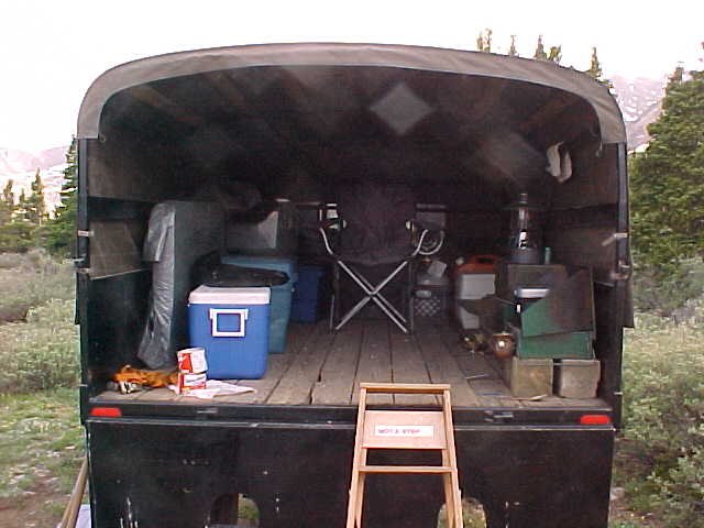
Plenty of room in the back of my truck to spread out all my gear after dinner and enjoy the evening, even if the weather was to deteriorate.
Trip Report by Kent Drummond photos by Kent Drummond and Ron DePugh